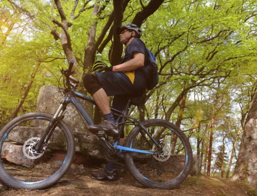
About Back 40 Trail - Lake Ann Trailhead
The Bella Vista Back 40 is one of Northwest Arkansas’s original big mountain bike systems, a roughly 40-mile network best known for its 21-mile perimeter loop. It’s flowy, climby, and remote-feeling, and it helped put Bella Vista on the map for riders.
Trail details
The Back 40 Loop is about 21 miles and wraps the whole system, with interior trails crisscrossing it so you can build shorter rides too. Expect grinding climbs that trade off with fast, swooping descents, plus standout sections like The Ledges, with its karst rock formations, and the rebuilt Rago, with rock features and jumps.
- Distance: about 40 miles total, with a 21-mile outer loop
- Difficulty: mostly intermediate; approachable flow with real climbing
- Surface: natural-surface dirt singletrack
- Standout features: The Ledges karst formations and the rocky, jumpy Rago
- Best for: intermediate riders who want a long, scenic loop
The park / where it is
The Back 40 sits on the east side of Bella Vista and rides remote even though it’s close to town. Lake Ann Trailhead is the main access point, with several other entries around the network, including Blowing Springs Park. The system connects to Slaughter Pen and Blowing Springs by way of the Razorback Regional Greenway, so it links into the broader Northwest Arkansas trail web.
Connected & nearby trails
The Back 40 is easy to pair with the rest of Bella Vista and Bentonville.
- Little Sugar is the newer all-weather Bella Vista system and the better pick after rain.
- Blowing Springs Park is a trailhead and camping basecamp connected to the Back 40.
- Slaughter Pen Trail in Bentonville links to the Back 40 via the Greenway.
- Huntley Gravity Park is nearby when you want downhill laps instead of long miles.
Know before you go
Plan for a real ride: carry water, food, and tools, because the loop is long and feels remote. It’s natural-surface dirt, so give it time to dry after rain and ride Little Sugar instead if it’s muddy. Class 1 pedal-assist e-bikes are generally accepted on Northwest Arkansas trails, but confirm current OZ Trails and Bella Vista POA rules. Grab a trail map and pick a loop length that matches your legs before you drop in from Lake Ann.
Frequently asked questions
How long is the Back 40 loop?
The signature Back 40 Loop is about 21 miles and encircles the whole network, with additional interior trails crisscrossing it for a system of roughly 40 miles total. You can ride the full loop or piece together shorter rides.
Is the Back 40 beginner-friendly?
It’s approachable flowy singletrack, but the full loop is a real day with grinding climbs and fast descents, so it fits intermediate riders best. Newer riders can ride shorter interior sections and build up.
Where do you park for the Back 40?
Lake Ann Trailhead is the primary access point, and there are several other entries, including Blowing Springs Park. Lake Ann is the easiest starting point for the classic loop.
What are the standout features?
Highlights include The Ledges with its karst rock formations and the rebuilt Rago section with rock features and jumps, all wrapped in a remote, wooded feel with lots of climbing and swooping descents.
Can you ride the Back 40 after rain?
It’s natural-surface dirt, so it needs time to dry out and can hold moisture longer than the nearby Little Sugar system. If it’s been wet, Little Sugar is usually the better all-weather choice.
Does it connect to other trails?
Yes. The Back 40 connects to Slaughter Pen and Blowing Springs via the Greenway, so you can link it into longer Northwest Arkansas rides.